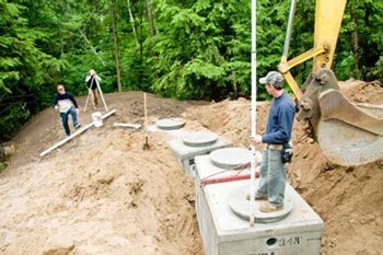
Boundary Survey
 A boundary survey is a survey to establish the boundaries of a parcel using its legal description which typically involves the setting or restoration of monuments or markers at the corners or along the lines of the parcel, often in the form of iron rods, pipes, or concrete monuments in the ground, or nails set in concrete or asphalt. In the past, wooden posts, blazes in trees, piled stone corners or other types of monuments have also been used. A map or plat is then drafted from the field data to provide a representation of the parcel surveyed.
For more information or a free quote, please contact Proline Surveying.


